Park at 1704 99th Street Northwest on a Saturday morning and you'll find the crowd headed toward the Osprey Loop, binoculars out, aiming for the boardwalks that skim the southern shore of Tampa Bay. Drive ten minutes south to 10299 9th Avenue Northwest that same morning and the scene is different: strollers, kids climbing rope nets under live oak canopy, a line forming at the NEST for the Saturday open house. Same preserve name on the sign. Same 682 acres on the map. Two entirely different mornings.
That split isn't an accident of crowd preference. It's structural, and it's been that way since a storm took out the one thing physically connecting the two halves.
Two Preserves Wearing One Name
Robinson Preserve opened to the public in 2007 on land Manatee County bought back from decades of farming. For its first several years it was one contiguous piece: the North Entrance, marked by the historic Valentine House (moved by boat from its original site in Palmetto), and the Osprey Loop that wraps the shoreline nearby.
Then the preserve grew twice in the same stretch. In 2016 the county leased the 52-acre Winston Tract just south of the original footprint, mostly dense mangrove. Around the same time, a 150-acre parcel that had been slated for residential development got pulled off that track entirely. Big Waters Land Trust bought it with a grant from the Mosaic Company Foundation, donated it to the county, and the county handed a perpetual conservation easement back to the trust, which means it can never be surplussed for anything other than a natural area park. That 150-acre addition, now called the Expansion, is where the NEST and the Canopy Zone treetop playground live today, accessed from the South Entrance at 9th Avenue Northwest.
So the preserve didn't expand outward from one center. It grew as two separate additions with two separate identities, joined by trails that were supposed to eventually stitch them into a single loop.
The Bridge That's Still Out
Here's the part that doesn't show up on the trail map you'll find online: the bridge connecting the Osprey Trail on the north side to the Eagle Trail on the south side has been closed since Hurricane damage in October 2024, and it hadn't reopened as of the most recent trail update. If you're picturing a single sweeping loop that lets you start at Valentine House, cross through the Expansion, and end at the NEST, that loop currently doesn't exist as a continuous walk. You do one half or the other, then drive between them if you want both.
This matters more than a footnote about storm cleanup. It means the two entrances aren't just different in character. Right now they're functionally different destinations, and the choice you make in the parking lot decides your whole visit.
Which Half Fits Your Saturday
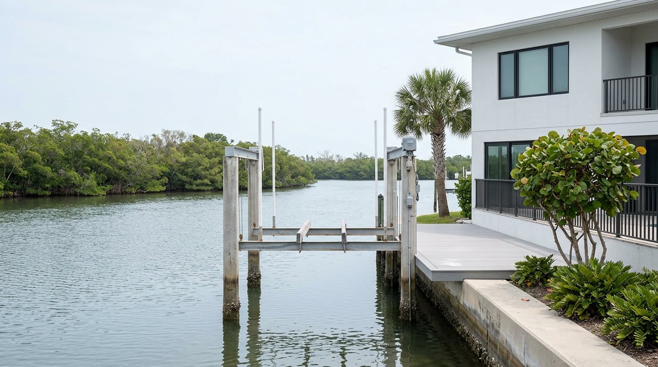
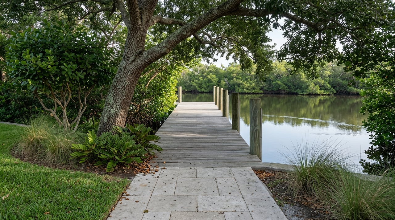
The North Entrance is where the preserve's original bones are. The Osprey Loop, at 3.3 miles, is the oldest of the loop trails and the one locals mean when they talk about the mangrove boardwalks and waterfront views toward the Skyway. It's also where most of the preserve's 40 kayak storage tubes sit, giving paddlers direct access to the Blueways Trails that lead out through Perico Bayou toward Palma Sola Bay.
The South Entrance, at the Expansion, is newer and built around a different kind of visit. The NEST, short for the Mosaic Center for Nature, Exploration, Science and Technology, anchors a 900-square-foot elevated building with a crow's-nest lookout and 360-degree views. Just outside it sits the Canopy Zone, a two-story treetop playground built on the historic Reasoner Tract, once a test plot for Royal Palm Nurseries, and designed with enough shade from century-old trees that it stays cool even in July. The Eagle Loop nearby runs on a rubberized, pedestrian-only surface that local runners favor precisely because it isn't ankle-twisting shell. This side also holds 120 kayak storage tubes, triple the north side's count, which tells you where paddling demand has actually grown since the Expansion opened.
| North Entrance (1704 99th St NW) | South Entrance / Expansion (10299 9th Ave NW) | |
|---|---|---|
| Historic anchor | Valentine House, relocated from Palmetto | Reasoner Tract, former Royal Palm Nurseries test plot |
| Signature trail | Osprey Loop, 3.3 miles, waterfront boardwalks | Eagle Loop, rubberized surface, sun-exposed |
| Family draw | Open shoreline, birding | NEST + Canopy Zone treetop playground |
| Kayak storage tubes | 40 | 120 |
| Shade | Limited, mostly open marsh | Better, live oak canopy near NEST |
Why August Decides For You Anyway
Most Robinson Preserve trail surfaces sit in full sun with little natural cover, and that's a real consideration in late August, not a minor inconvenience. The North Entrance's Osprey Loop, for all its shoreline appeal, offers almost no shade along its length. The South Entrance flips that. The Canopy Zone and the tree cover around the NEST make that side the more comfortable choice for a mid-morning visit this time of year, regardless of which trail character you'd normally prefer.
If paddling is the plan instead of walking, the Blueways routes reward attention to tide charts. Higher water makes the mangrove channels easier to navigate without scraping a hull, and that's true on either side of the preserve.
The Free Habit Worth Building
The NEST runs an open house every Saturday from 9 a.m. to noon, no reservation required, and it's the kind of standing weekend option that's easy to forget exists until you need something free and air-conditioned-adjacent for an hour. Aedan Stockdale, who manages the county's Education and Volunteer Division, put the scale of what happens there in context:
"We do approximately 500 different education programs a year. This is from, you know, preschool programs all the way up to senior programs, yoga in the preserve, Tai Chi classes, art classes, kayak trips, stargazing nights, anything we can do to get people outside."
That's not a seasonal push. It's a year-round operation running out of a building most visitors treat as a photo stop on the way to the playground.
Small Logistics That Save a Trip
A few operational details are easy to miss until they cost you a wasted drive:
- Kayak storage tubes run $480 a year plus tax, renewable annually for up to five years, and are split 40 tubes at the North Entrance to 120 at the South Entrance's Expansion lot.
- The county periodically closes the paved Spoonbill Trail for prescribed burns that maintain the native habitat and cut wildfire risk. A detour stays open on both sides of the preserve during these closures, so the day isn't lost, just rerouted.
- The preserve closes early each spring for its annual Twilight 5K/10K, reopening the next morning on normal sunrise-to-sunset hours.
- Leashed dogs are welcome throughout, but water fountains and hoses are only available at the parking lots, not out on the trails themselves.
None of this makes the preserve harder to enjoy. It just means the version of Robinson Preserve that shows up in a five-minute search, one big park with one trail system, isn't quite the park that's actually on the ground right now.
The Practical Takeaway
Robinson Preserve will eventually get its bridge back and the two halves will read as one property again. Until then, the honest advice for a Bradenton local planning a Saturday is to pick a side on purpose. Shade, kids, and a standing free program mean the South Entrance. Open water views, the original boardwalks, and serious kayak mileage mean the North. Either one is a full morning. Trying to do both without a car in between is the plan that falls apart around mile three.
For everything else about what it's actually like to build a routine in this part of Bradenton, from the preserves to the water access that shapes daily life here, Costa Living keeps a closer eye on this corner of the Gulf Coast than most. If a move here is somewhere in your thinking, schedule a free consultation and we'll talk through what a week actually looks like on this side of the county.